Current and historical maps of Putnoe in Bedford are provided on this page, including a 1967 map of the area around Putnoe Farm (Now Hartop Close).
Current Putnoe Map
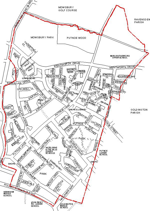
The red line on this map indicates the boundary of Putnoe Manor in the 18th Century. If you have ever wondered where Putnoe stops and Goldington starts then this map is as good a guide as any. However, for a 2nd opinion you can also look at the 2011 census and Electoral maps further down this page which have redefined Putnoes boundaries on all sides.
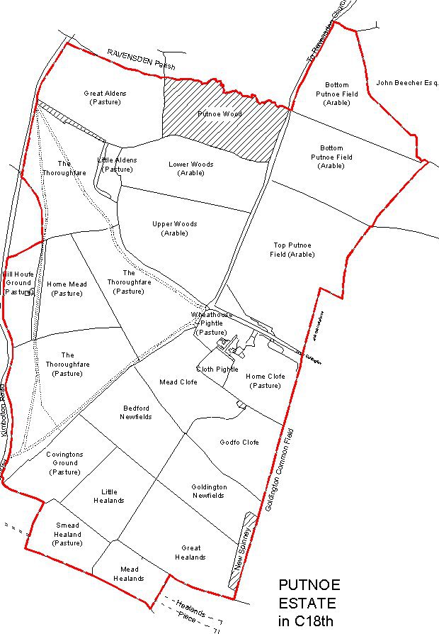
Map of Putnoe Manor in 18th Century
This is a map of Putnoe Manor towards the end of the 18th Century. The field names, field use and boundaries are indicated. The hatched areas are woodland. The extent of Putnoe Wood is very similar to present day. Putnoe farm was located by Wheathouse Pightle, Cloth Pightle and Home Clofe. Note that in the 18th Century 'f' was used in some words in place of 's'. The red line on this map indicates the boundary of Putnoe Manor at this time.
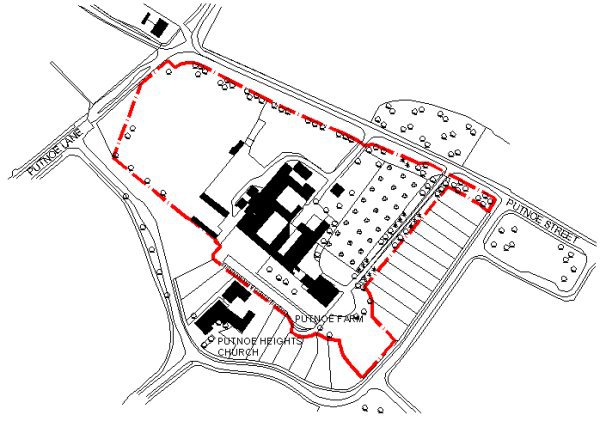
Map of Putnoe Farm in 1967
This is a map of Putnoe Farm just before it was demolished in 1967/68.
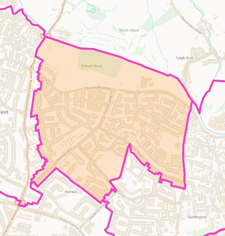
2011 Putnoe Census Map
This is a map of Putnoe based on the 2011 census. Comparing the blue shaded area to the 'Original' historical Putnoe Manor boundary you will see the following differences:
- Properties on the Eastern side of Kimbolton Road are now in the Brickhill Parish.
- Stancliffe Road and the area South of this is outside Putnoe.
- Properties along Haylands way are in Goldington Parish.
- Putnoe extends East along Putnoe Street to Church Street, then North to take an area North of Wentworth Drive, including Mark Rutherford School.
According to the 2011 censusPutnoe has:
- 7198 people living in this area.
- 2919 properties.
- Covers an area of 221 hectares.
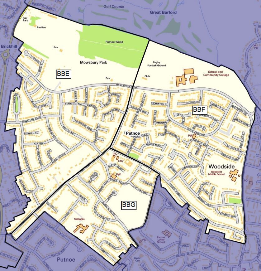
Putnoe Electoral Maps
The electoral ward maps cover the same areas and have an identical boundary to the 2011 census map (see above).
Putnoe is an electoral ward within the unitary authority of Bedford. It is a borough divided into voting areas. Based on 2014 figures it has:
- 3108 Propertes.
- 6161 eligible voters.
The first map below shows the electoral boundary of Putnoe, with Brickhill to the West, Goldington to the East and DePary's to the South. The second map shows the three electoral areas within Putnoe (2014).
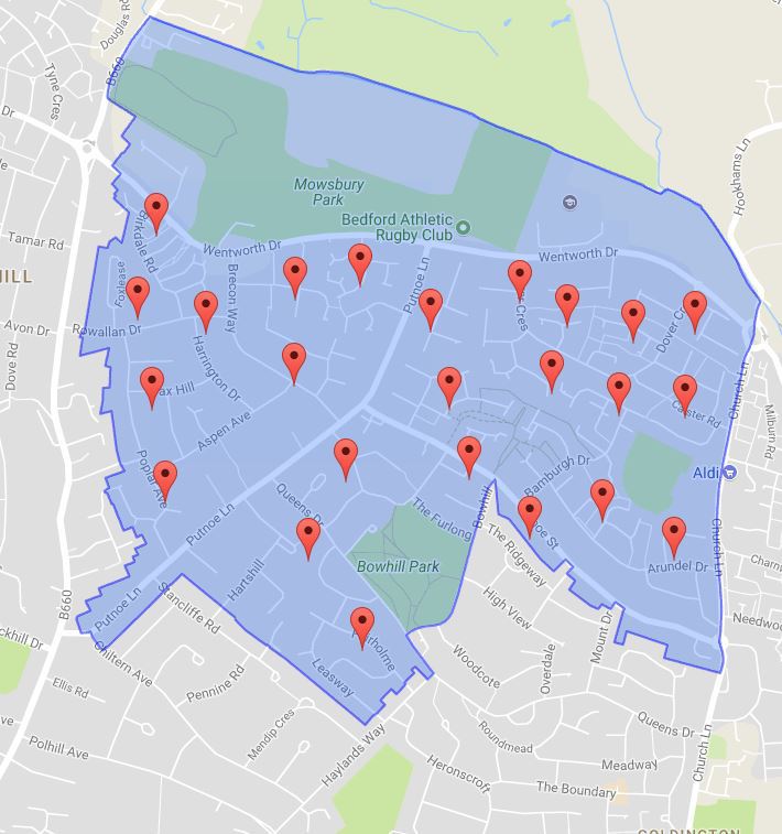
Putnoe Police Map
The Putnoe Police map is similar to the 2011 census map:
- The Northern boundary is the same.
- The Western boundary is the same until Putnoe Lane, then extends further south to the rear of the properties along Polhill Avenue.
- The Southern boundary runs parallel to Polhill Avenue (along the rear to the properties) until Haylands Way.
- From Bow Hill, Putnoe extends East parallel to Putnoe Street to Church Street, with properties on both sides of Putnoe Street being in Goldington.
